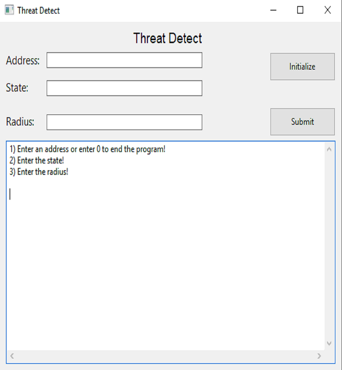
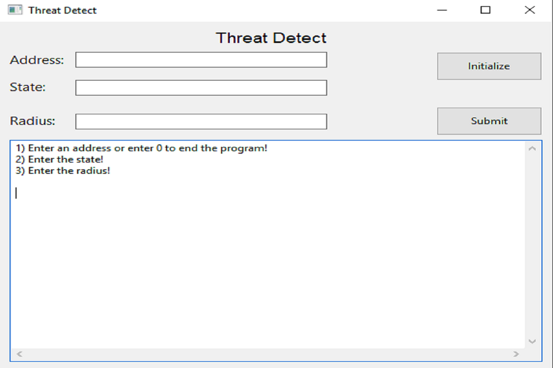
ThreatDetect
ThreatDetect is an application that was created as a final project for my Software Engineering Practice and Experience course with a group of 5 (including myself). This application takes a valid (existing) address, the respective state of the address, and a radius measured in kilometers as input, then outputs the amount of incidents related to gun violence that occured within the given radius. The dataset that is used to display the information is government issued and contains the exact addresses, longitude, and latitude coordinates of gun violence incidents from 2013-2018 in the United States. Through the use of a geocoder, we were able to convert addresses to their respective coordinates in order to determine which incidents resided within the given radius. The application also includes a graphical user interface to make it user friendly.
After thorough testing, it was determined that the graphical user interface increased the overal time complexity of the application. Hence, we decided to make the GUI optional and included a console-based application as well. The console based application displayed all the information onto the console as well as a text file that is returned as output.
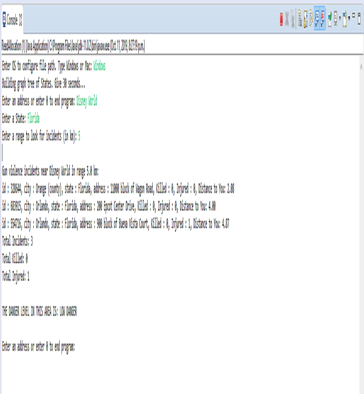
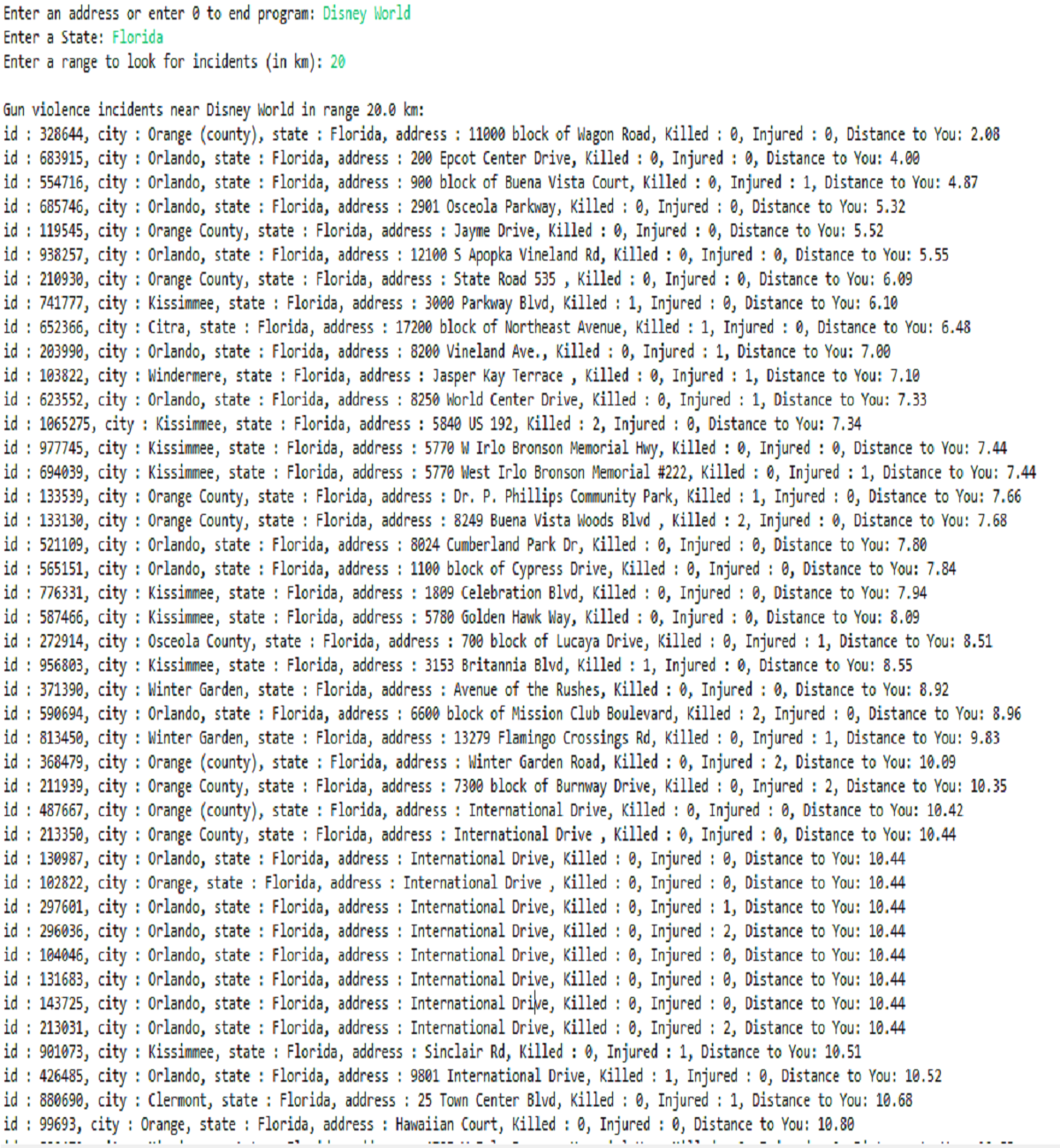
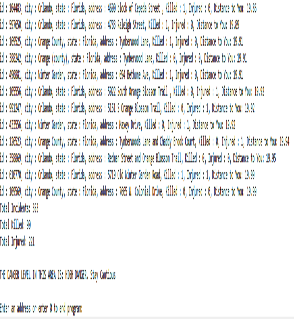
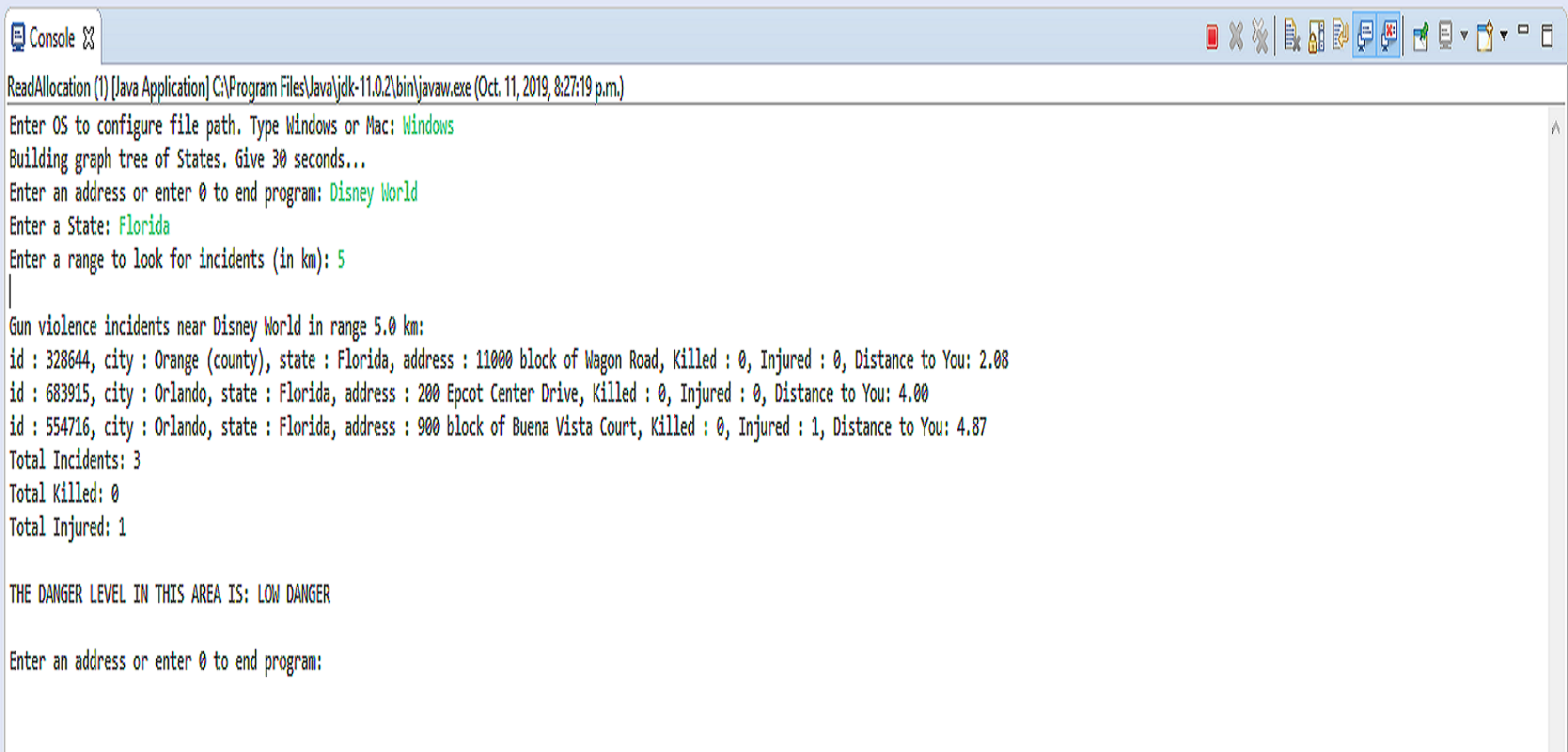
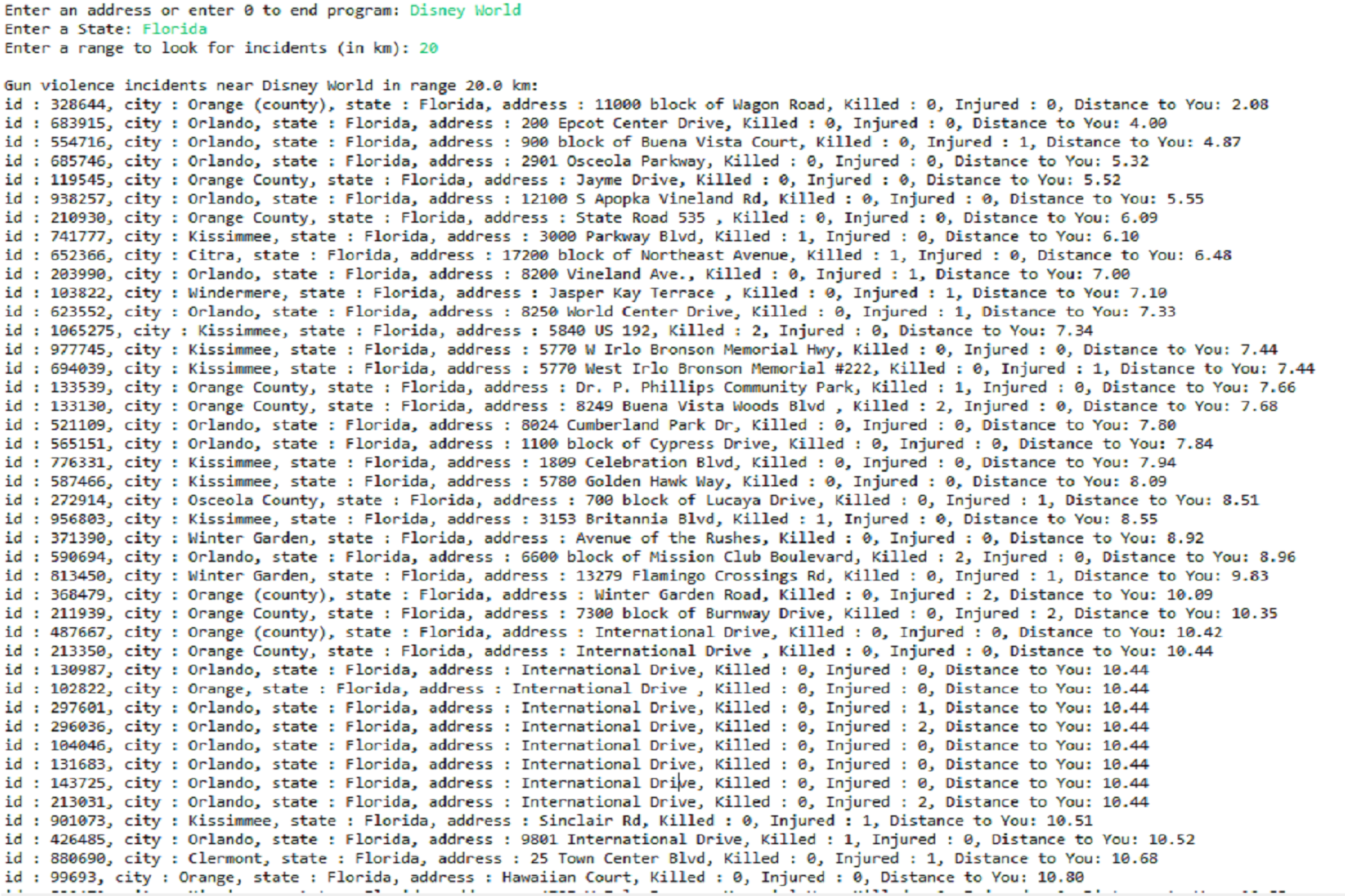
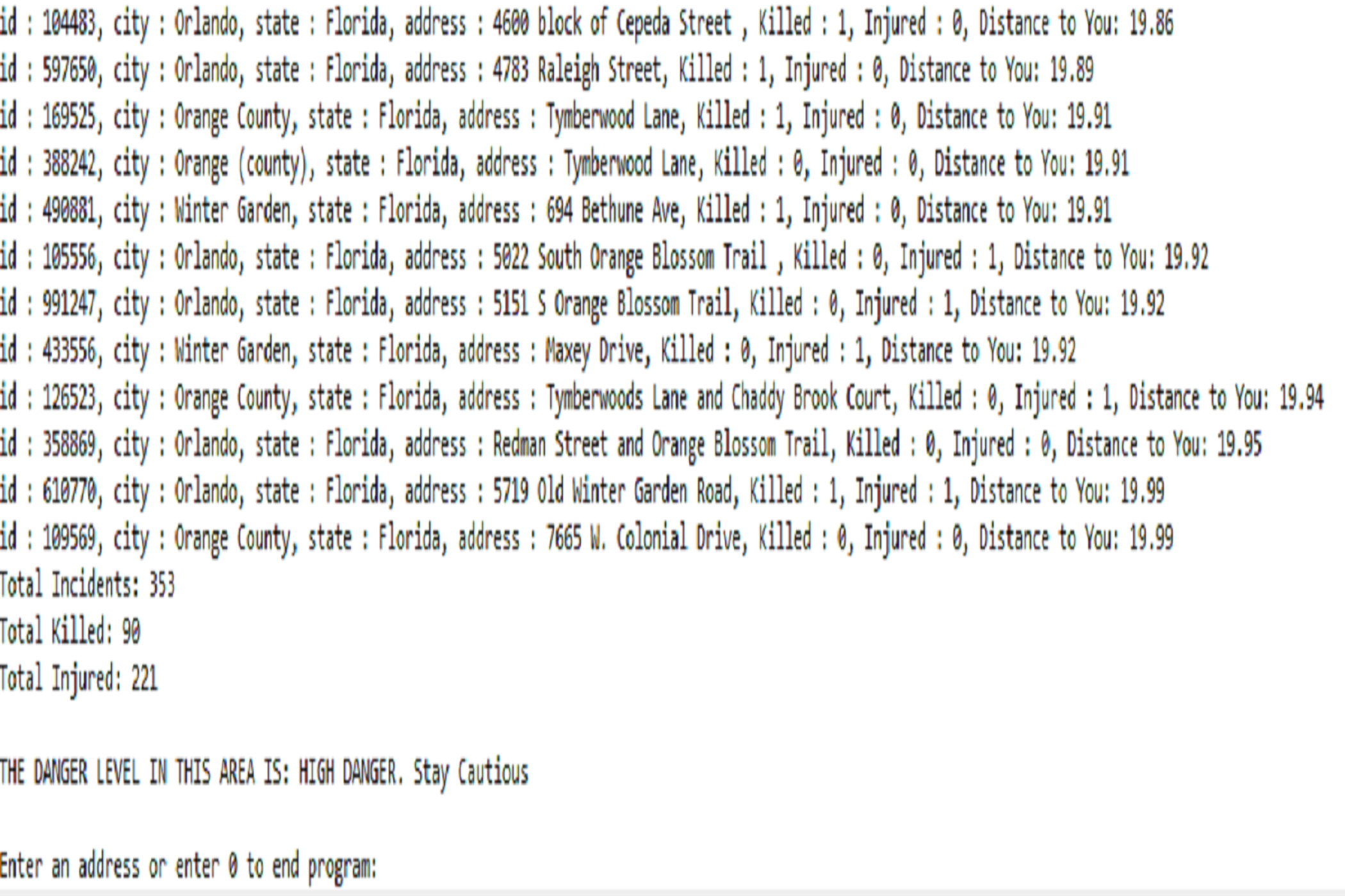
As you can see from the pictures, upon increasing the radius, the number of incidents also increased. A final threat level is also determined based on a formula devised by the group. This application manages to search and sort hundreds of thousands of data entries in mere seconds through the optimized use of a Red-Black BST and quicksort. This is one of my favourite projects as it greatly enhanced my understanding of important data structures, algorithms, and the importance of time complexity.
All source code is available upon request.